
Full Technical Specification
Every symbol set, calculation engine, and export in YELME MAP
Built around local storage privacy, open coordinate standards (WGS84 / MGRS / DMS), keyless global elevation tiles, and doctrine-aligned briefing outputs across Web, iPadOS, and iOS.
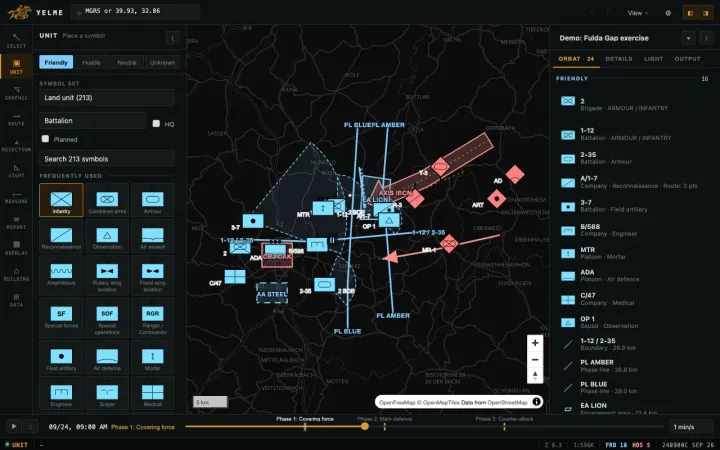
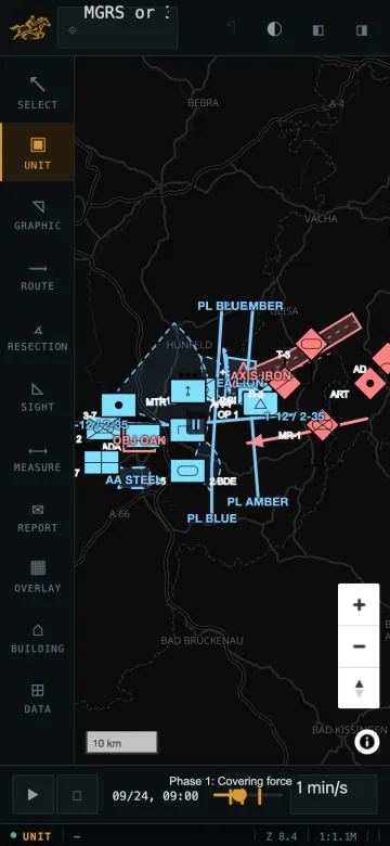
1. Complete 16-Set MIL-STD-2525E Catalog (1,370 Symbols)
Every icon entity is generated programmatically from milsymbol 30-digit SIDC specifications with 4 affiliations, 14 echelons (Team to Region), HQ/Planned modifiers, NATO vs. Inverse Soviet color schemes, and 0–300 km range sectors.
| SIDC Set | English Set | Turkish Label | Entities | Sample Icons |
|---|---|---|---|---|
| 25 | Control Measure | Kontrol tedbiri | 269 | Check point, TRP, action point, release point |
| 15 | Land Equipment | Teçhizat | 223 | Armor, artillery, radar, armored personnel carrier |
| 10 | Land Unit | Kara birliği | 213 | Infantry, combined arms, armour, recon, mortar, engineer |
| 40 | Activity / Incident | Faaliyet / olay | 148 | Arrest, fire, demonstration, patrol incident |
| 20 | Installation | Tesis | 129 | Airfield, power station, depot, bridge, hospital |
| 30 | Sea Surface | Deniz yüzey | 93 | Frigate, corvette, carrier, amphibious assault ship |
| 60 | Cyberspace | Siber | 65 | Combat mission team, cyber protection, threat sensor |
| 36 | Mine Warfare | Mayın harbi | 59 | Bottom mine, moored mine, minefield sweep area |
| 01 | Air | Hava | 52 | Fighter, fixed wing, rotary wing, UAS, medevac |
| 27 | Land Dismounted Individual | Tekil personel | 45 | Dismounted infantry, scout, medic, engineer |
| 05 | Space | Uzay | 36 | Spacecraft, orbital relay, re-entry vehicle |
| 35 | Sea Subsurface | Denizaltı | 22 | Submarine surfaced/submerged, AUV, UUV |
| 11 | Land Civilian | Sivil | 11 | Government organization, humanitarian NGO, civil group |
| 51 | SIGINT | Sinyal istihbaratı | 3 | Communications intercept, jammer / ECM, radar sensor |
| 02 | Air Missile | Hava füze | 1 | Surface-to-air & air-to-air missile tracks |
| 06 | Space Missile | Uzay füze | 1 | Ballistic & orbital missile trajectory icon |
2. Tactical Control Graphics (13 Types)
Linear Control Measures
Phase Line (PL), Boundary (with echelon tick), Line of Departure (LD/LC), Obstacle (serrated)
Direction Arrows
Axis of Advance (wide band + arrowhead), Supporting/Free Tactical Arrow
Tactical Areas
Objective (OBJ), Engagement Area (EA), Assembly Area (AA, dashed), Named Area of Interest (NAI), Target Area of Interest (TAI)
Freeform Annotations
Unlabeled free polyline, arrow, and area overlays
3. Exports & Interoperability
A4 / A3 Briefing PDF
Cover header block, optional classification banner, north arrow, scale bar, faction legend, multi-phase pages, and full ORBAT task-organization table.
PNG Raster (1x / 2x / 3x)
High-DPI briefing snapshot automatically clamped to GPU canvas limits.
DA Form 5517 Range Card
Sector sketch with MGRS firing position, left/right azimuth limits, concentric rings (50m–10km), and computed azimuth/range/MGRS data table.
KML / KMZ & GeoJSON
Preserves 30-digit MIL-STD-2525E SIDC metadata inside KML ExtendedData so units re-import cleanly.
ATAK Data Package (.zip)
CoT point events + manifest ready to import as editable markers inside ATAK.
WebM Timeline Video
Records 15/30/60/90 frames at smooth FPS across timed unit movement and phase transitions.
4. Field Reports, Resection & Elevation Verification
Radio-Ready Reports
Pre-filled MGRS location and automatic DTG timezone timestamps for SALUTE, 9-Line MEDEVAC, Call for Fire (observer-to-target mil azimuth & range), and SITREP templates.
Polar, Intersection & Resection
Compute unknown target or own-position MGRS coordinates in degrees or 6400 NATO mils with optional Grid-Magnetic (G-M) declination angle and geometric intersection quality warning (30–150 deg optimal).
Measured Building Analysis
Reads real OpenStreetMap polygons to compute oriented bounding box, perimeter, area, corners, and fit user-uploaded floorplans cleanly onto roofs without synthesizing fake interior rooms.